July 29 2005 Grindelwald to Lauterbrunnen
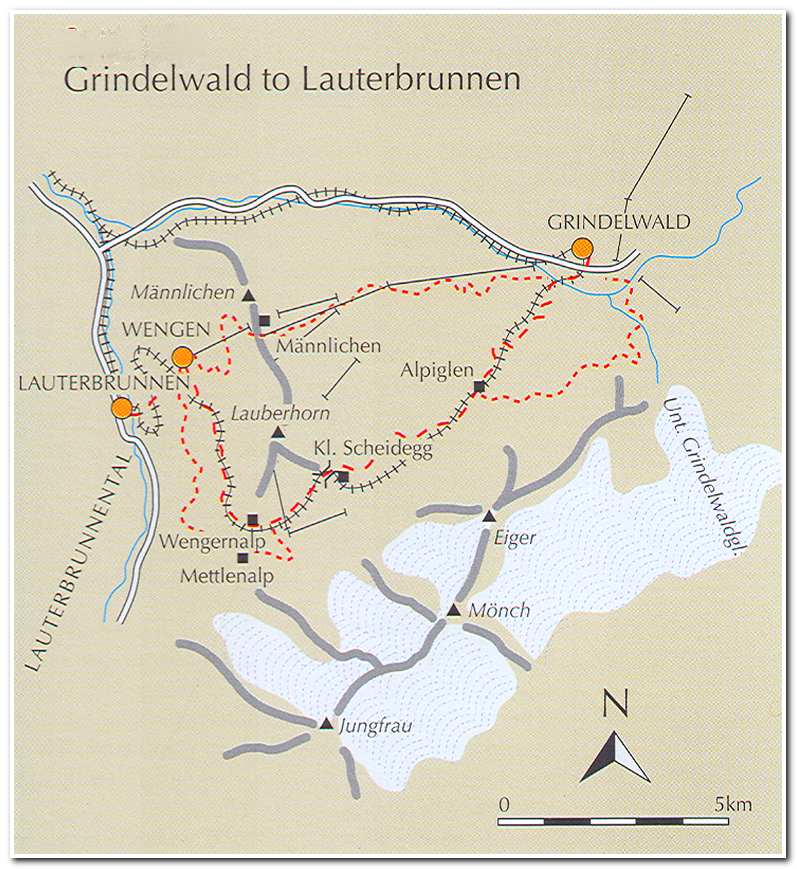
After spending a night in Grindelwald and visiting with Thomas Luck and his wife whom I met on the trail in Meiringen and then again at Tom’s Cabin in Grindelwald I set down the hill from Grindelwald to Grund about a half mile distant. I then took the tram from Grund to Mannlichen which sits atop the ridge that separates Grindelwald from Wengen and the Lauterbrunnen valley. From the top station of the tram, there is a world class walk along a trail to Kleine Scheidegg (10:45; ca. 6760 feet). This trail provides a spectacular view across to the Eiger, the Monch and the Jungfrau and is one of the highpoints of the trip from a scenic point of view.
After pausing at Kleine Scheidegg to take in the view I continued west toward Wengen and the Lauterbrunnen Valley. A short distance downhill I came to Wengernalp (11:05, ca. 6000). After passing through several pastures and small forested areas I entered Wengen (ca. 4185) about an hour later.
Located on a wide terrace about 1600 feet above the Lauterbrunnen valley, Wengen is a popular tourist-visited and car free town, with great views over the classic carved glacial valley below, and to the Jungfrau, Mettighorn, Briethorn and Tschingelhorn at the head of the valley. The descent the rest of the way from Wengen to the valley floor was steep and hot and I was glad to finally arrive in Lauterbrunnen (ca. 2615 feet) at about 1:00 in the afternoon. From there I took the funicular train up to Murren (ca. 5372 feet) located on top of the 2760 foot cliff that is to the west side of the Lauterbrunnen Valley. Once in Murren I checked into the Hotel Alpina right on the cliff edge and enjoyed the view along with a few liters of the local beer.
-

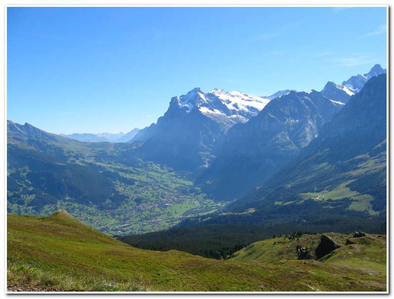
- View from Mannlichen toward Grosse Scheidegg and the Wetterhorn rising above Grindelwald
-
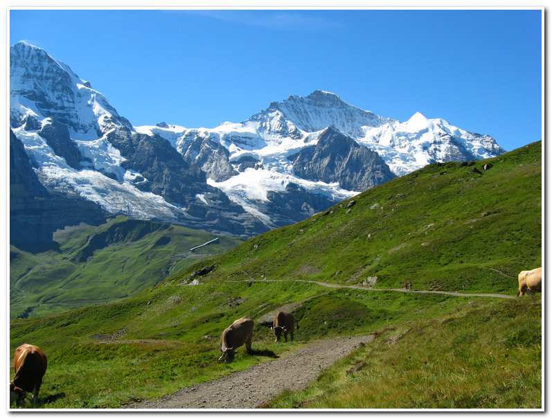
- View toward the Jungfrau from the Mannlichen/Kleine Scheidegg trail
-
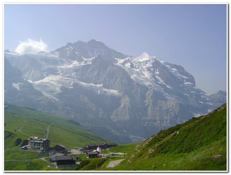
- View of Kleine Scheidegg and the Jungfrau
-
- On the descent to Wengen, in the distance
-
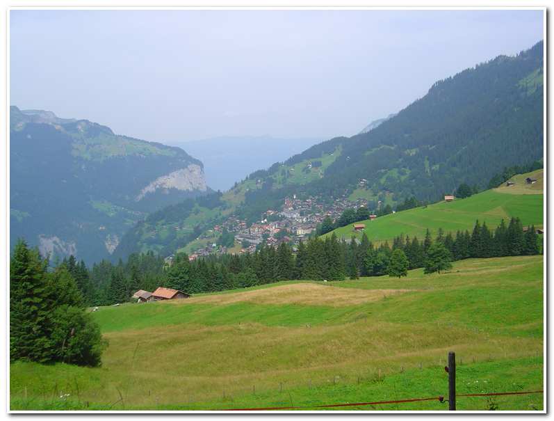
- View of the Lauterbrunnen valley from Room 35, Hotel Alpina, in Murren

-
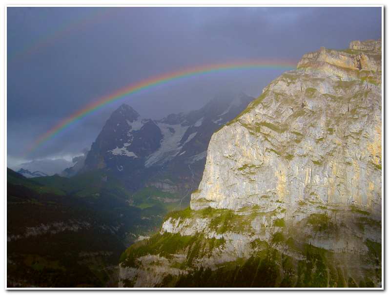
- An afternoon thunderstorm creates a rainbow arching over the Eiger
July 30 2005 Rain day, no travel.
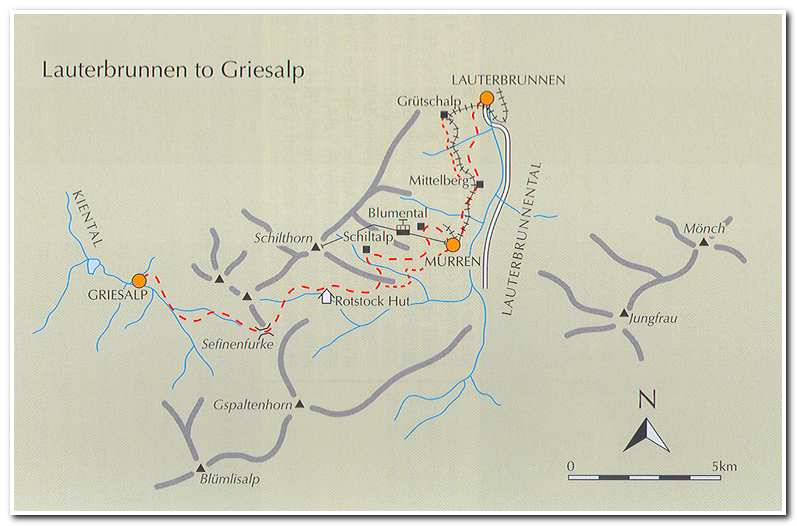
July 31 2005 Lauterbrunnen to Griesalp
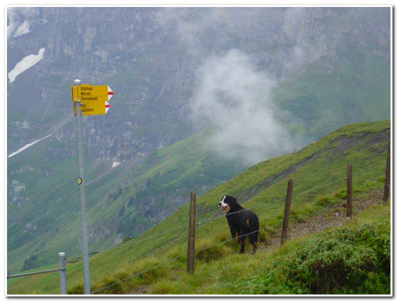
I left Murren at 7:45 on a cloudy damp day, but the rain that persisted all day on the 30th had past and so I pressed on. I took the trail out of town up toward Blumental and reached the Pension Sonnenberg (8:20; ca. 6035 feet. From there it was about ten minutes to Pension Suppenalp (8:30; ca. 6075 feet). A path then led to up and around a brushy spur and on to Shiltalp (9:00; ca. 6390 feet), a collection of cheese makers’ huts. A short distance past the huts I was joined by a Swiss mountain dog out wandering the trail. She followed me over another steep brushy spur and on to the Rotstock Hut (10:15; ca.6690 feet), where I stopped and had hot soup before continuing alone on up the trail toward the Sefinenfurke, the pass that leads to Griesalp.
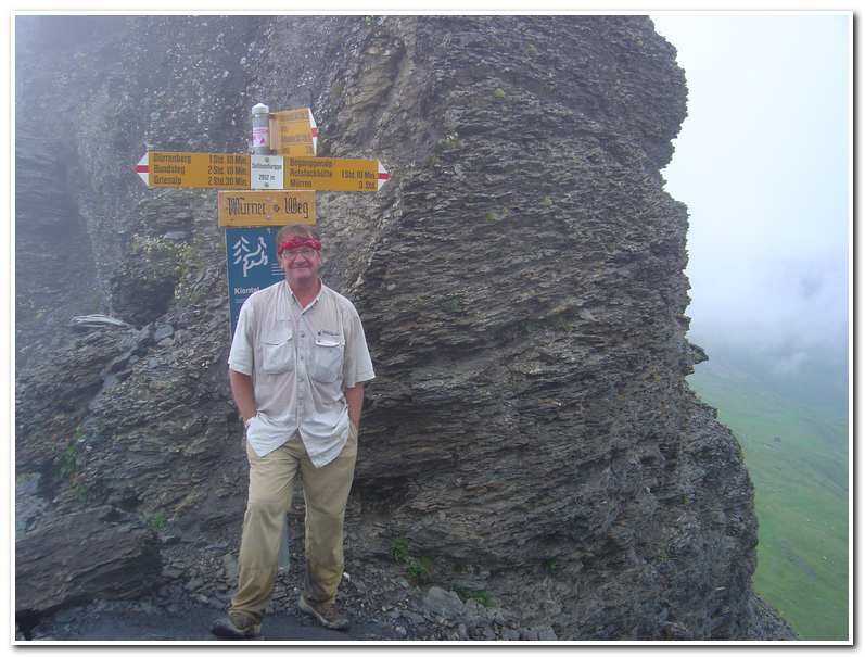
After the Rotstock Hut I hiked up through a large basin of grass and rocks and over old moraine banks. The last part of the trail ascended steep switchbacks over shale scree before finally arriving at the Sefinenfurke (12:15; ca. 8595 feet).
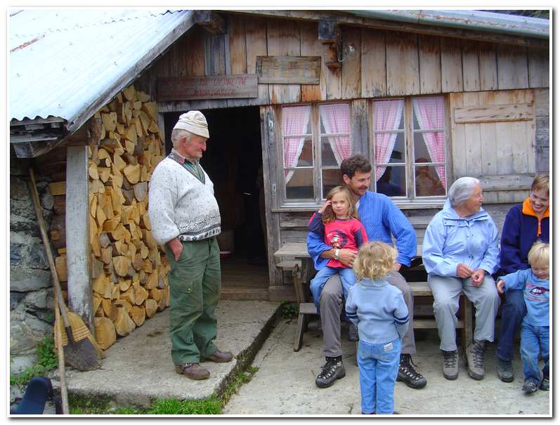
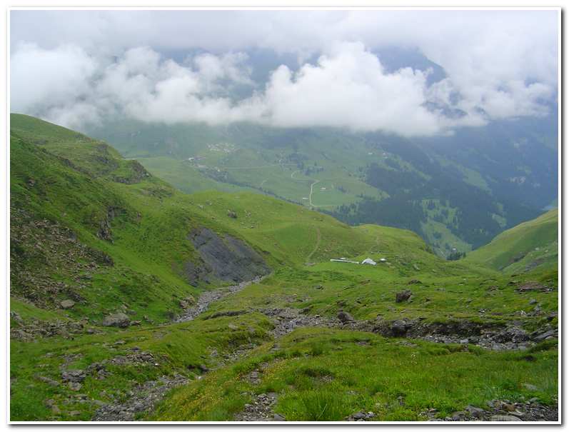
The weather at the Sefinenfurke was foggy and cold so I wasn’t able to enjoy the view but it was a relief to have crossed one the highest passes on the route. The descent involved several sections of fixed cables and countless timber steps which crossed steep shale scree. After about an hour I came to the farm of Ober Durrenberg (1:30; ca. 6540 feet). Here I enjoyed a cup of hot soup and the old farmer that owned the place repaired my severely cracked walking stick with cow hoof mending tape. Thus fortified I continued on down a steep hillside and an hour later reached Burgli (2:30; ca. 5300 feet). From there it was a short hike down to Griesalp and the Berggasthaus Golderli (3:00; ca. 4725 feet). This had been a long day but was only a taste of the next stage, over the Hohturli to Kandersteg.
-
- My hiking partner. A Swiss Mountain Dog followed along for several hours.
-
- In the mists at the Sefinenfurke
-
- Breaking out of the fog just above Ober Durrenberg
-
- The farmer (left) who repaired my Alpenstock