July 3 2006 Col des Mosses to Montreux
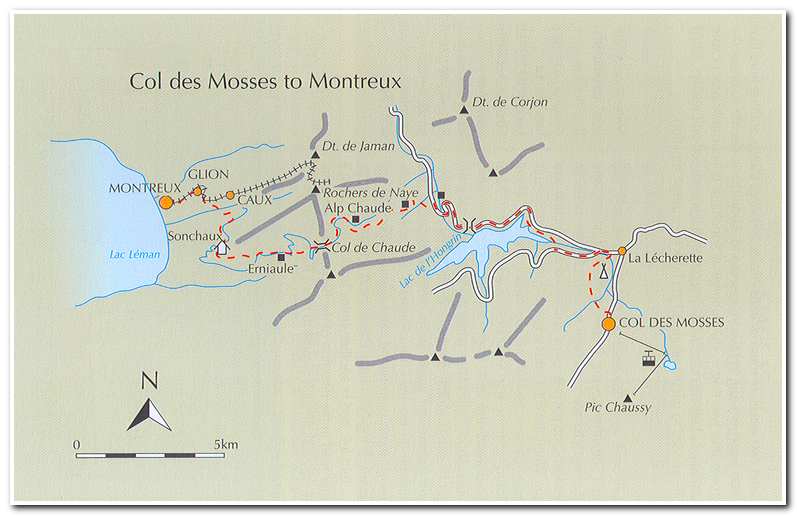
The last day of the Alpine Pass Route started by walking north along the road out of Col des Mosses (8:10) and past the lower gondola station up Pic Chaussy then turning left along a narrow road signed to La Lecherette. At a T junction the route turned right. Soon the road ended and the trail continued along a soggy pasture and alongside meadows, till about twenty-five minutes after the start I came to a small farm. I continued along the farm track and in a few minutes, when the track forked I took the right branch, which wound downhill through woods and pastures, finally emerging near a military camp (8:50).
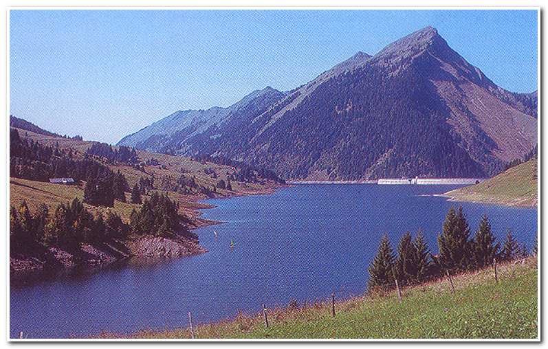
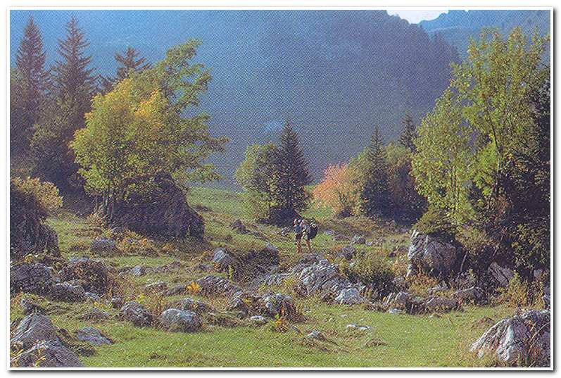
Here I turned left and in another few minutes I turned right along a minor road in the direction of the Barrage de l’Hongrin. The road cuts through a steep rocky gorge to reach the eastern end of the Lac de l’Hongrin (9:10) and then a track led around the north bank of the lake to the Barrage de l’Hongrin (10:15; ca. 4122 feet). From here I took the old road down through the tunnel above the gorge and out to a view of the deep, steeply walled Hongrin valley. I descended down into the valley finally coming to Vuichaude d’en Bas (11:00; ca. 3610 feet) on the valley floor. On the left of the road a sign marked the start of a path to Vuichaud d’en Haut and Col de Chaude. The trail cut across a large slope of pastureland and then steeply up through woodland till at last I came to the small farm of Vuichaude d’en Haut (11:45; ca. 4382 feet). I went around the left hand side of the farm house on the path and on into a belt of woodland. The way was muddy in places, but planks had been laid over the worst sections. After about fifteen minutes I came to a pretty little valley littered with limestone boulders and streams meandering through groups of trees.
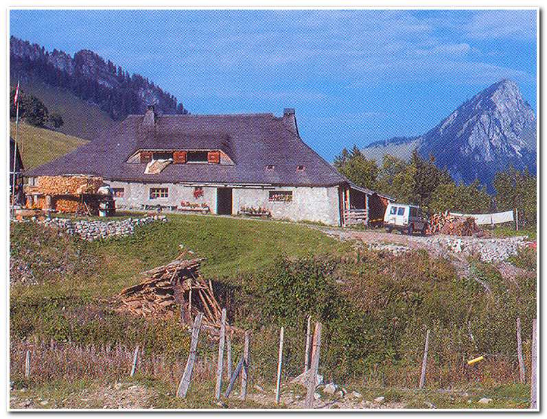
Here the way veered to the right and crossed the valley’s main stream and emerged at Alp Chaude (12:10; ca. 4838 feet). After having a snack at the Alp I continued up the valley to its head at Col de Chaude (1:00; ca. 5316 feet), where I had my first view of Lake Geneva nearly 4000 feet below. From the Col I walked down the road as it twisted and turned until I came to a couple of buildings where a trail broke away from the road and descended to the left. The trail went through rough pastures and among trees and eventually returned to the road at a hairpin bend. I walked down the road and after about 0.4 of a mile I passed two more buildings at Erniaule (1:30; 3975 feet). I went right at the fork in the road just after Erniaule and followed this branch until a track cut off to the right signed to Sonchaux.
This track soon passed a rough cheese maker’s hut and continued its long trek around the wooded hillside. Eventually the path came to Sonchaux (2:30; 4136 feet). From Sonchaux I kept to the road for another fifteen minutes and then took a path that dropped steeply through deciduous forest, before coming onto a track where I turned right. The descent continued at a more comfortable gradient now and then came onto a paved road where I went left to Glion (4:00; ca. 2322 feet).
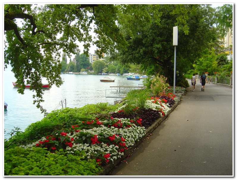
From Glion it was a short funicular ride down to the Montreux Bahnhof and the end of the Alpine Pass Route.
-

- Lac de l’Hongrin
-
- Alpine valley just below Alp Chaude
-
- Alp Chaude
-
- Lakefront Promenade at Montreux