The Next Year
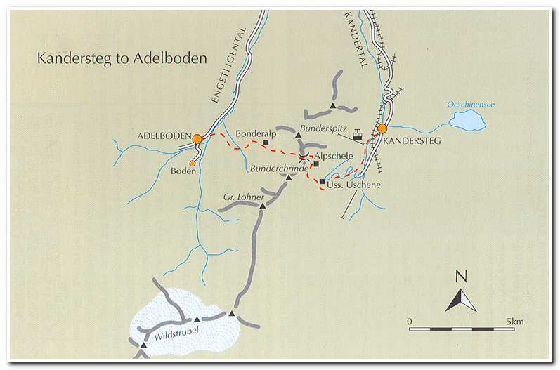
June 29 2006 Kandersteg to Adelboden
I returned to Kandersteg in 2006 determined to finish the Alpine Pass Route across the Swiss Alps. On June 28th I arrived in Kandersteg and checked into the Ritter Victoria once again. On the 29th the weather was partly cloudy and about 60 degrees, perfect for hiking through the mountains.
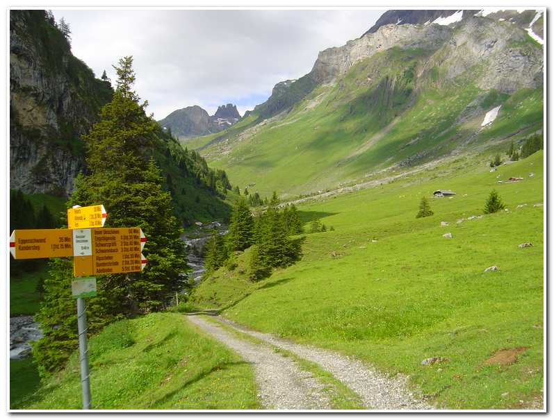
I left Kandersteg at 9:00 and walked along the road past the Bahnhof (train station) and followed a small road left which followed the railroad tracks heading south. The trail soon veered right under a bridge crossed the River Kander and went along a narrow road toward the landing site of the Kandersteg paragliding center. From here a path continued along the river and soon came past the international scout camp. Just after the camp the trail broke to the right and across the meadows. From the meadows the path rose steeply to a road. After crossing this I continued through more woodland before coming onto the road once more. After following the road for another 6 – 7 minutes it made a right-hand hairpin, at which point I went on a way-marked path rising above the Alpbach stream. This path rejoined the road at another hairpin turn where again I followed the way-marked path climbing through a narrow gorge and out into the open pastures of Usser Uschene (10:20; ca. 5077 feet).
I continued ahead across the pasture keeping below the main alp buildings. At the far end of the pastures I came to a junction of farm tracks and took the upper right option that switch backed uphill. Just before it came to an alp building about 30 minutes from Usser Uschene I cut left on a path which climbed toward a band of grey cliffs.
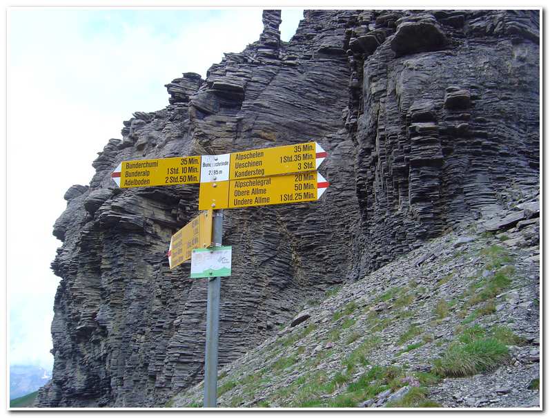
The path swung to the left and crossed a stream and then climbed steeply up through the cliff band on a fault line before cutting to the right over boulder slopes. A short time later I came to the group of three huts Alpschele (ca. 6870 feet). The path then rose between the buildings and traversed to the right across an increasingly stony hillside, before winding up to a junction of paths and a signpost on the edge of a broad slope of scree. The trail then slanted upward across the scree and soon came to the Bunderchrinde (ca. 7822 feet).
As I sat in the foggy narrow cleft of the Bunderchrinde having a celebratory cigar I heard alphorn music drifting up from far below on the Adelboden side of the pass. The ‘concert’ lasted about 20 minutes with two alphornists seeming to be locked in a competition, one echoing the other before launching into his own opus. This was one of those once-in-a-lifetime moments of perfection.
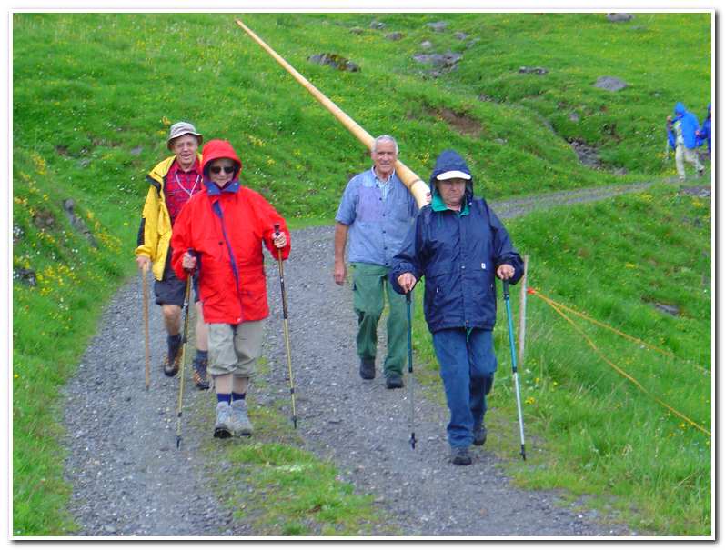
The descent began steeply and took me along a switch-backing path over steep scree slopes to a grassy bluff and high pasture before descending to a farm road which soon brought me to the Berghaus Bonderalp. As it turned out this was the home of one of the alphornists I had heard up on the mountain and so I had a chance to thank him in person for the recital.
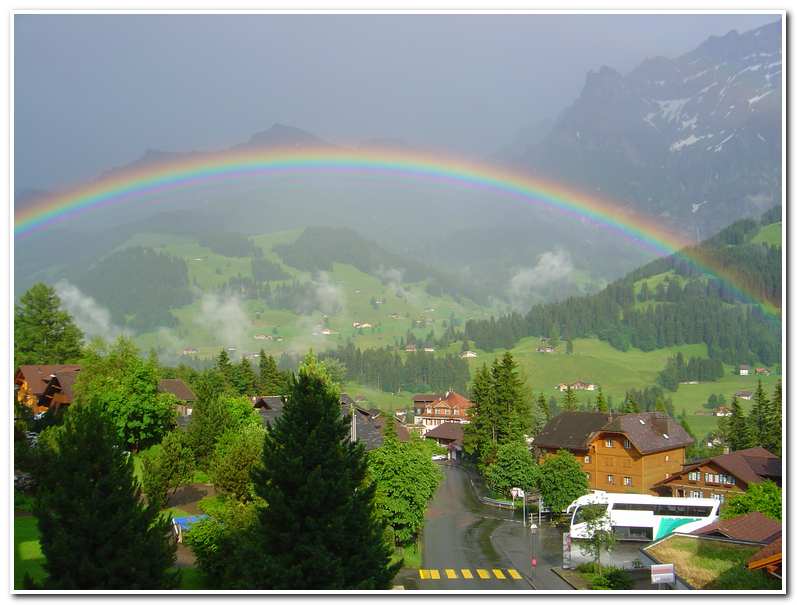
After a snack of soup and local beer I walked on down, in a thunderstorm, to Adelboden and checked into the Victoria Eden Hotel.
-

- Kandersteg and the Ritter Victoria Hotel patio

-
- Looking toward the Bunderchrinde from just below Usser Uschene
-
- Signpost at the Bunderchrinde
-
- Alphorn player on the way to Berghaus Bonderalp
-
- Rainbow over Adelboden after thunderstorm