


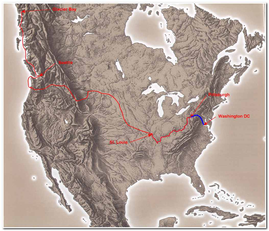
Trek from Washington DC to Pittsburgh
Via the C and O Canal
and the Allegany Highlands Trail
Total length 320 miles
Segment #1: The C and O Canal;
Washington DC to Cumberland, Maryland:
187 miles
This traces the trek from Washington DC to Pittsburgh, a total distance of 320 miles. My adventure started in Washington DC, on the shores of the Potomac River, at the Army War College near Anacostia, home of the offices of the Joint Chiefs of Staff. The route from the War College to the beginning of the famous C and O Canal and loosely followed the route of the long forgotten Washington City Canal from the Potomac north to the Capital building and then west across the Capital Mall then up Pennsylvania Avenue past the White House. From the White House I hiked to the C and O Canal trail-head in Georgetown. The Washington City Canal was constructed in 1810 during Madison’s presidency and ran from the Potomac River to the Washington Branch of the C and O Canal, joining at what is now the corner of 17th and Constitution Avenue. This canal was used until about 1855 when it was abandoned and eventually largely replaced with Constitution Avenue, which runs along the north side of the Mall. The old lock house at the corner of 17th and Constitution still stands and is now a public toilet.
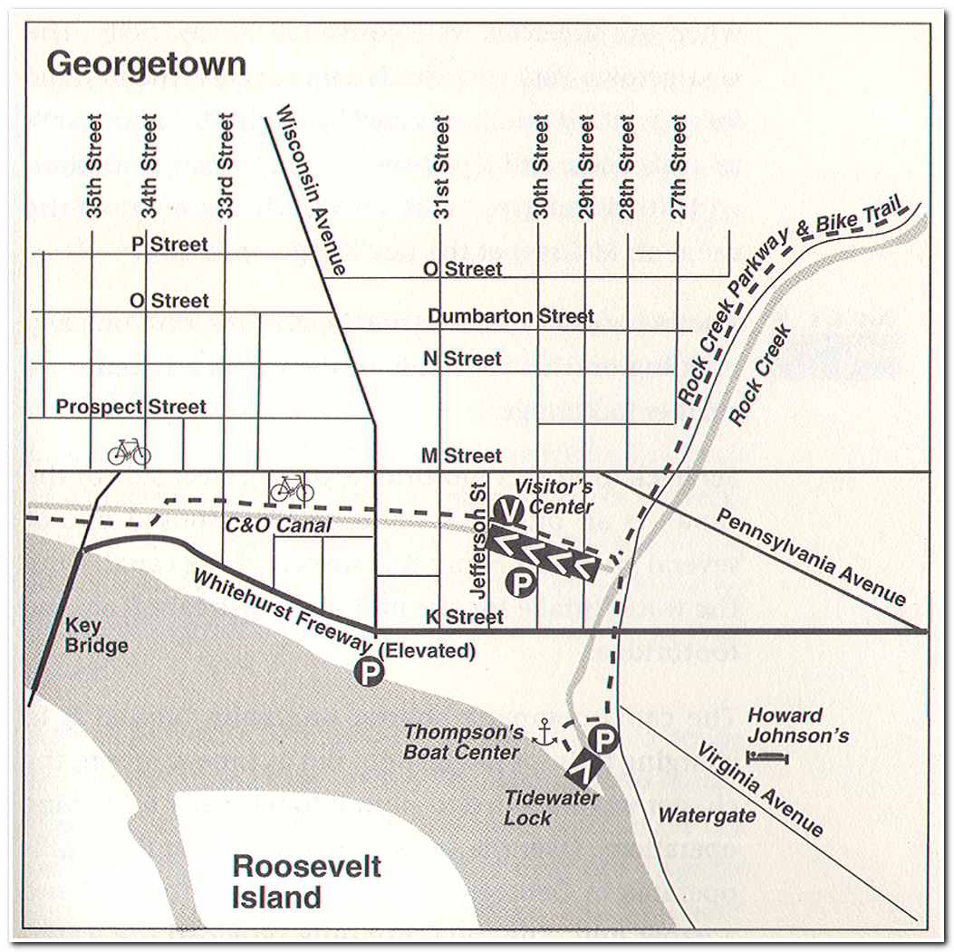
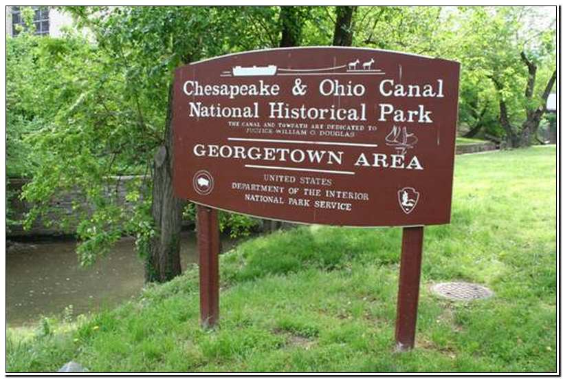
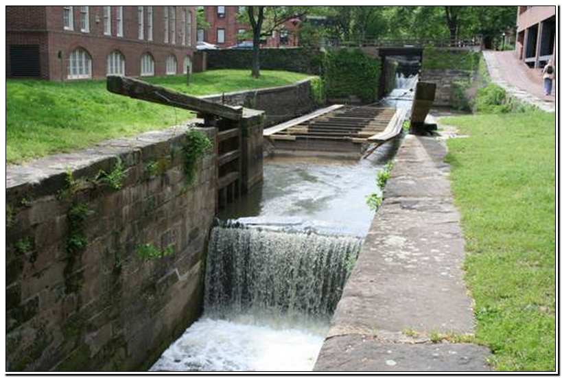
The trailhead of the C and O Canal (milepost 0) is near the Four Seasons Hotel in Georgetown and offers a pleasant urban walk through Georgetown and then generally north out of Washington DC along the Potomac. I soon left the hustle of the big city behind and the trail, which is actually the towpath along side the canal, continues through a park like setting past a number of old canal locks. There are 74 lift locks between Washington and the canal terminus at Cumberland, Maryland with lifts of between 6 and 10 feet (8.2 foot average) for a total lift of 610 feet in 184.5 miles. The locks are 90 feet long, 15 feet wide (the canal boats were 14 ½ feet wide) and 16 feet deep. Horses and mules were used as tow animals and for the most part the towpath follows the river side of the canal.
After about 5 miles I passed Locks #5 and 6 at Little Falls I crossed the boundary between Washington DC and the state of Maryland. Lock #6 named “Magazine Lock” after the US Powder Magazine 0.3 miles upstream where President Adams inaugurated C and O Canal construction on the 4th of July 1828 (the canal ceased operation in 1924). Soon I began to settle into my 3.5 mile per hour hiking pace.
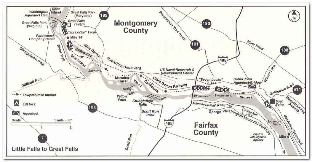
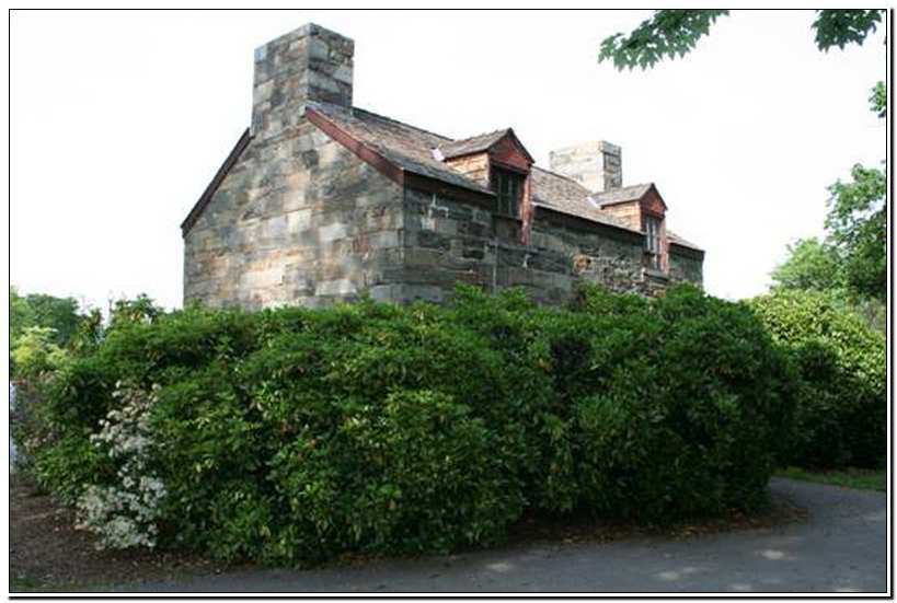
At milepost 8.4 I passed by Lock #8, the first of the ‘Seven Locks’ that are passed within a one mile stretch and raised the barge traffic about 50 feet in total. About three hours from the start I passed under the Capital Beltway bridges (milepost 9.3) and past Lock #14. At milepost 9.6 I passed the Naval Ship Research and Development Center. This extensive installation includes a 2775 foot deep water model basin where the Navy’s ship and aircraft experts learn how ships and their machinery and aircraft are likely to behave in their real life environment. At mile 9.9 there is a sign designating the start of the “Billy Goat Trail”. This 1.7 mile loop trail along the river that meanders through forest and rocky outcroppings and provided a nice change of pace to the tamer and more predictable towpath trail along the canal. At milepost 10.9 I rejoined the towpath and continued on to Great Falls Tavern (milepost 14.4). This well known tourist site and was once a lock house for Lock #20 and a hotel for visitors to the Great Falls of the Potomac. From Great Falls it was another two hours of gentle hiking to Lock #23 (milepost 22) near the town of Seneca, the terminus for my first day on the canal.
-

- Old Lock House on the corner of 17th and Constitution Avenue in Washington DC
-
- Start of the C and O Trail in Georgetown
-
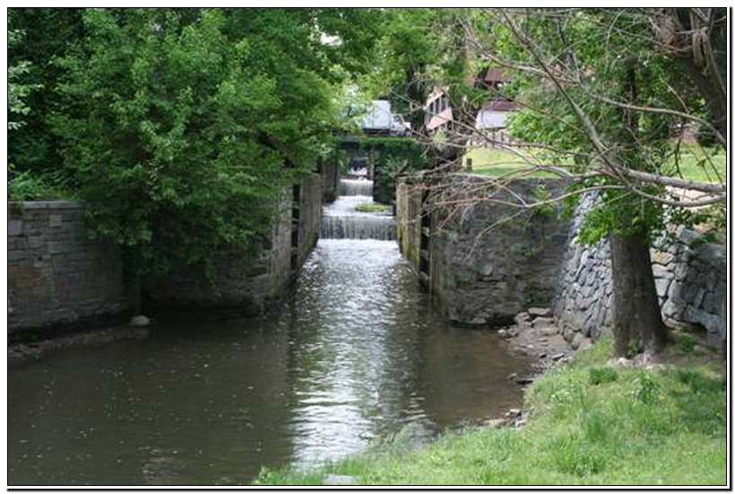
- Looking up the C and O Canal toward Locks 1 – 4
-
- At Lock looking toward Lock 4
-
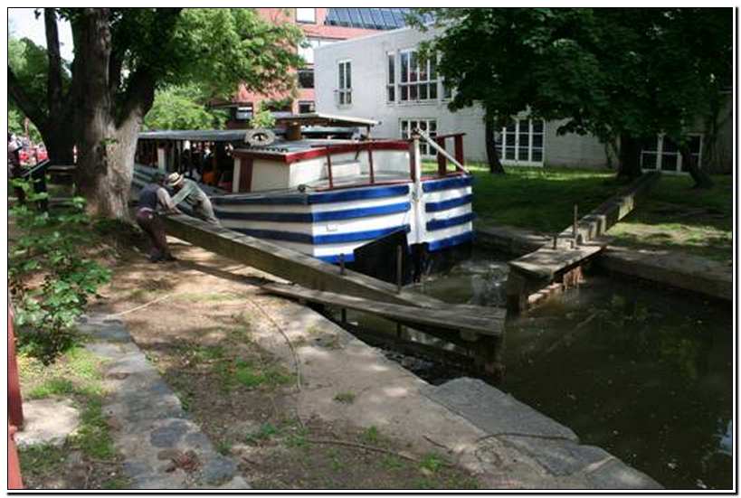
- Lock hands closing the gate on Lock 4 for a canal boat
-
- C and O Canal passing through Georgetown

Pages: 1 2 3 4 5 6 7 8 9 10 11 12 13 14 15 16 17 18 19 20 21 Next »